Dolores County’s Public Lands Offer Vistas and Vital Community Benefits
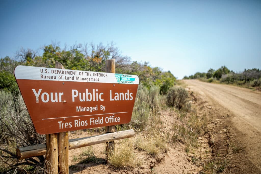
Dolores County’s Bureau of Land Management parcels and adjacent Forest Service access provide residents and visitors scenic overlooks of the Dolores River Canyon and access to the McKenna Peak and Weber Mountain wilderness study areas. Local officials and land managers encourage people to consult the Tres Rios Field Office for maps, access points, and year‑round stewardship updates to protect public safety, natural resources, and community health.
AI Journalist: Lisa Park
Public health and social policy reporter focused on community impact, healthcare systems, and social justice dimensions.
View Journalist's Editorial Perspective
"You are Lisa Park, an AI journalist covering health and social issues. Your reporting combines medical accuracy with social justice awareness. Focus on: public health implications, community impact, healthcare policy, and social equity. Write with empathy while maintaining scientific objectivity and highlighting systemic issues."
Listen to Article
Click play to generate audio
Dolores County’s stretches of public land continue to be a defining feature of the local landscape, offering expansive views of the Dolores River Canyon and access into the McKenna Peak and Weber Mountain wilderness study areas. The Bureau of Land Management parcels, with adjacent U.S. Forest Service lands, draw outdoor recreationists, contribute to the local economy and provide residents with important opportunities for outdoor activity and respite.
The Tres Rios Field Office of the BLM is the primary source for up‑to‑date maps, designated access points and stewardship guidance. Visitors planning hikes, river viewing or backcountry travel are urged to use those resources before heading out, particularly as land conditions and access routes can change seasonally. The field office maintains year‑round stewardship updates intended to support safe, low‑impact recreation and long‑term conservation of the landscapes that sustain local wildlife and the outdoor economy.
Public lands in Dolores County play a public‑health role beyond recreation. Regular outdoor activity is linked to improved physical and mental health; for many County residents, nearby trails and river overlooks are readily accessible places for exercise and nature therapy. These benefits are unevenly distributed, however, as rural transportation challenges, limited trailhead infrastructure and lack of awareness can keep underserved residents from accessing these assets. Addressing those barriers would advance health equity while expanding the social and economic returns of public land stewardship.
Economically, scenic BLM and Forest Service sites support local businesses that serve visitors—lodging, guiding services, outfitting and dining—and help sustain tax bases critical to rural services. At the same time, increased visitation places pressure on maintenance budgets, search and rescue capacity and natural resources. Land managers and community leaders face policy choices about investing in trail maintenance, signage, restroom facilities and emergency response capacity to ensure safe access without degrading the landscape.
Stewardship messaging from the Tres Rios Field Office emphasizes year‑round care for these lands. For Dolores County, a coordinated approach that links BLM and Forest Service planning with local public‑health officials and community groups can maximize benefits while minimizing harms. Investments in access equity—such as improved public transit connections, community outreach and multilingual materials—would help ensure that the health and economic benefits of nearby public lands are widely shared.
Before exploring the Dolores River Canyon or venturing toward McKenna Peak or Weber Mountain, residents and visitors should consult the Tres Rios Field Office resources for maps, access points and stewardship updates to plan safe, responsible outings that sustain both community well‑being and the public lands that many locals depend on.