Eastern Oregon helicopter crash kills four after hitting slackline
Officials say a private helicopter crashed after striking a slackline, killing four with ties to Eastern Oregon; federal investigations are ongoing.
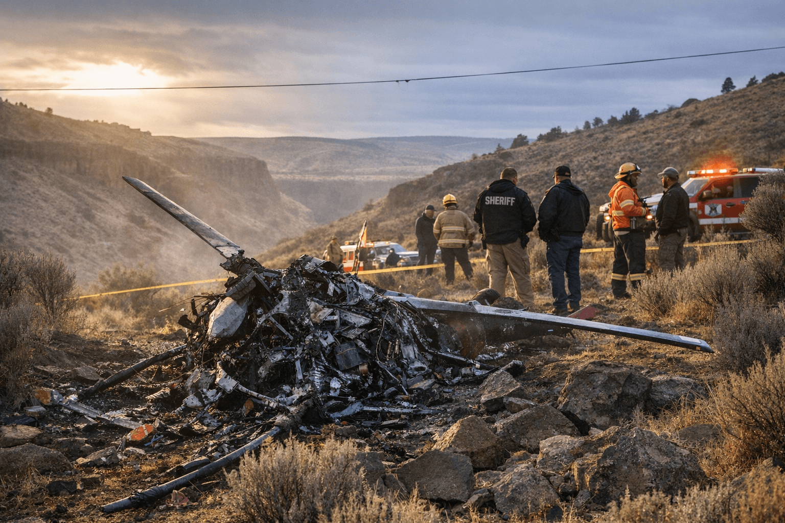
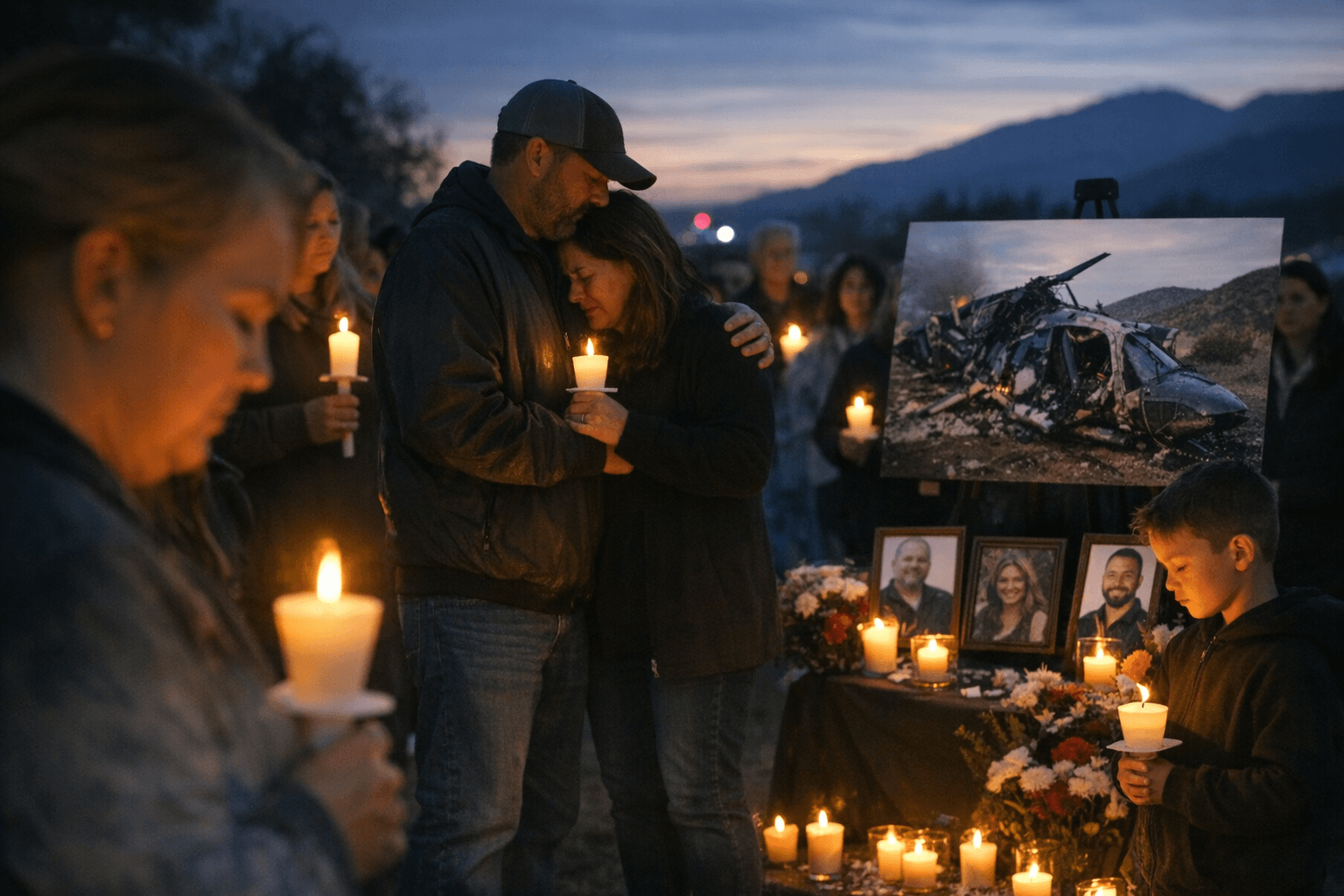
A private helicopter carrying four people with ties to Eastern Oregon struck a suspended recreational slackline and crashed near Superior, Arizona, on Jan. 5, 2026, killing all aboard. The victims were identified as David McCarty, 59, owner of Columbia Basin Helicopters based in La Grande and a Baker County resident; Rachel McCarty, 23; Faith McCarty, 21, of Echo; and Katelyn Heideman, 21, of Hermiston. The loss has reverberated through La Grande, Baker County, Echo and Hermiston, where the families and local aviation community are mourning.
Preliminary reports from the National Transportation Safety Board and the Federal Aviation Administration indicate the helicopter struck a highline - a recreational slackline reported to be more than one kilometer long - that was suspended across the terrain. Officials say a NOTAM, or notice to air missions, had been issued for the area. An NTSB investigator finished on-scene work and a preliminary factual report is expected within about 30 days; the final investigative report could take 12 to 24 months.
For Union County and nearby Eastern Oregon communities, the crash has immediate human and economic effects. Columbia Basin Helicopters provided local services and charter operations; the death of its owner leaves a business gap that may affect crop dusting, emergency support and private charters that small counties rely on. Families and friends in Echo, Hermiston and Baker County have lost four members, three of them young adults connected to local schools and social networks, amplifying the emotional impact across small-town circles.
The incident raises practical safety and regulatory questions that will matter at the local level. The reported length of the slackline and the issuance of a NOTAM suggest both recreational users and aviators took some steps to manage risk, yet a collision still occurred. The ongoing FAA and NTSB investigations will examine visibility of the line, marking or lighting, pilot awareness and NOTAM dissemination practices. Results could prompt changes in how long-distance highlines are permitted, how they must be marked, or how pilots are alerted to unusual low-altitude hazards in recreational areas.
Local pilots, flight operators and outdoor recreation groups will watch the federal findings closely. For small aviation businesses and county emergency planners, any recommended changes could require updates to safety protocols and community outreach to prevent similar tragedies.
The takeaway? Verify NOTAMs and communicate directly across user groups. If you fly in remote areas, double-check flight notices and share plans with local operators. And for our part, check on neighbors, support the families, and keep the local aviation community connected through this difficult time.
Sources:
Know something we missed? Have a correction or additional information?
Submit a Tip