Eugene seeks input to improve Polk Street bike connection
City of Eugene sought public feedback on plans to upgrade Polk Street into a north-south bike route; changes could affect safety and daily travel in Whiteaker and Friendly.
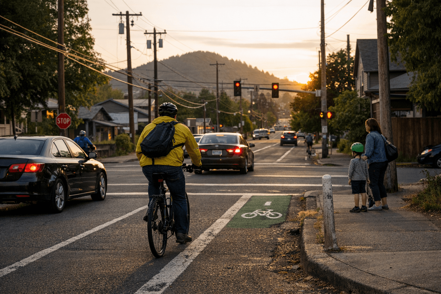
The City of Eugene sought public feedback on Jan. 12 on a plan to improve Polk Street as a north-south bicycle connection through the Whiteaker and Friendly neighborhoods. The corridor under study covers roughly 16 blocks and was originally identified in 2017 as an important but unsafe route for people riding bikes.
City staff described the effort as the next phase of work to evaluate design options and outreach strategies. The planning process will look at ways to make the corridor safer for bicyclists while balancing neighborhood access and street function. Residents are invited to participate in upcoming public input opportunities as staff move from assessment toward design.
Polk Street’s prioritization in 2017 reflected longstanding concerns about safe, direct north-south routes for people on bikes. Connecting neighborhoods like Whiteaker and Friendly with a clearer, lower-stress bike corridor would change commuting choices for residents, offer more options for short trips to schools and shops, and could reduce vehicle trips on parallel streets. For a city working to expand active transportation networks, this project represents a concrete piece of a broader multimodal plan.
The initiative has policy implications beyond striping and signage. Design choices will carry trade-offs for parking, traffic flow, and curb access that affect local businesses and households. How the city balances those trade-offs will reveal priorities among safety, speed, and neighborhood character. The level and diversity of public participation in the current outreach phase will shape those outcomes: community input can influence whether the project favors protected bike lanes, buffered lanes, traffic calming, or lower-cost improvements.
Institutionally, the process underscores the role of incremental planning in Eugene’s transportation program. A corridor identified nearly a decade ago is now moving into design, highlighting how funding cycles, technical analysis, and public engagement interact over multiple years. For advocates and residents, the present outreach window is a key moment to press for specific safety treatments and to request data-driven analysis of expected impacts.
Local riders and neighbors should watch the outreach schedule, attend planning events, and provide concrete suggestions about problem locations, curb uses, and traffic behavior. The city’s evaluation phase will translate community input into schematic designs that determine the next steps.
Our two cents? If this corridor matters to your daily ride, show up and be specific—point to exact blocks, parking conflicts, and crossing needs. Practical input now is the clearest way to turn a decade-old priority into safer streets you’ll actually use.
Sources:
Know something we missed? Have a correction or additional information?
Submit a Tip