Hernando County launches GeoHub and land development map
Hernando County unveiled a GeoHub and GIS map and will host virtual forums so residents can look up zoning, setbacks, heights and other land rules.

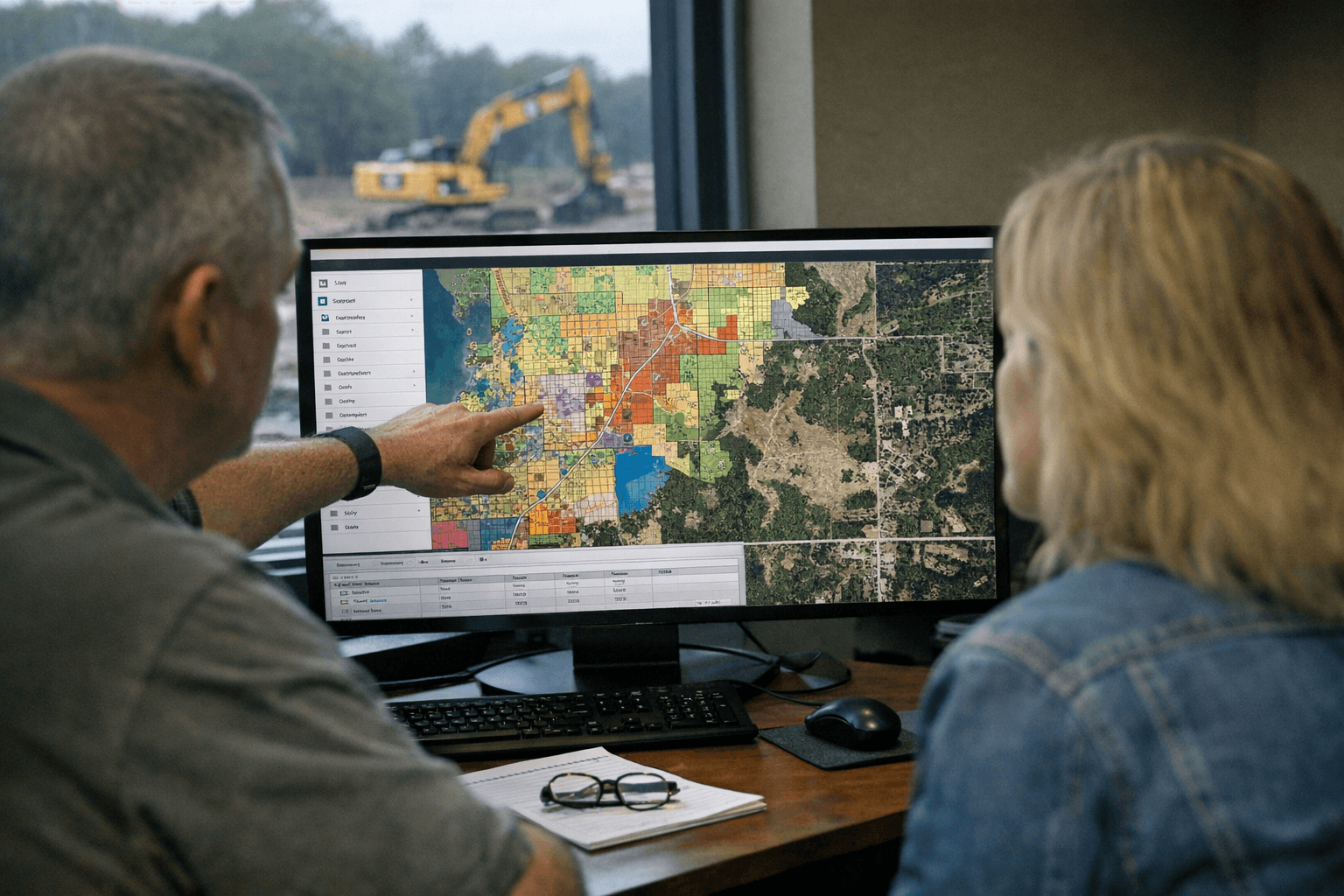
Hernando County announced on Jan. 13, 2026, the rollout of Phase 1 of a new GeoHub and an accompanying Land Development Regulations GIS map designed to centralize property-level zoning and development information. The county is offering two one-hour virtual community forums - Jan. 16 and Jan. 23, 10:00 to 11:00 AM ET - to demonstrate the tool, guide users through its features, and answer questions.
The GeoHub aims to let residents look up properties by address or parcel, view zoning and future land use designations, check setbacks and maximum building heights, and consult other land development regulations in a single, user-friendly interface. Development Services staff will lead a live demonstration and walkthrough during the forums, with time reserved for participant questions. Registration links are available on the Greater Hernando County Chamber of Commerce site at business.hernandochamber.com/news/details/virtual-community-forum-to-highlight-hernando-county-s-new-land-development-gis-map, and county Development Services can be reached at 352-754-4057.
For homeowners in Spring Hill, Brooksville, Weeki Wachee and the county’s smaller communities, the GeoHub promises to remove layers of uncertainty that often surround property projects. Instead of piecing together zoning maps, code text and permit requirements from different offices, residents will be able to check crucial limits - such as setback lines or height caps - before making plans to build, add on, or contest a permit. That clarity matters for property sales, neighborhood associations monitoring local changes, and small contractors preparing permit applications.
The tool also arrives at a time when many local governments are moving public records online to improve transparency and speed administrative decisions. A centralized GIS map reduces phone tag and site visits for routine questions, potentially trimming delays for simple permits and lowering the barrier to civic participation for residents who cannot visit county offices in person.
There are practical steps Hernando property owners can take now. Sign up for one of the Jan. 16 or Jan. 23 sessions to see the interface in action, have your parcel ID or address ready for the walkthrough, and note any questions about setbacks or permitted uses before calling Development Services. If you cannot attend, call 352-754-4057 for guidance or to request assistance.
Our two cents? Learn the tool before you start a project. A few minutes on the GeoHub can save headaches and hard-earned dollars when you are planning changes to your property.
Sources:
Know something we missed? Have a correction or additional information?
Submit a Tip