High surf and minor coastal flooding strike north and west shores, impacts contained
A National Weather Service high surf advisory and minor coastal flood statement affected north and west facing shores of Kauaʻi and Niʻihau beginning noon on December 4, with predicted breaking waves of 10 to 16 feet and isolated minor flooding in low lying coastal areas. Surf subsided by December 6 and advisories were lifted in some zones, but the episode highlights ongoing risks to shoreline infrastructure, local businesses and the need for continued coastal resilience planning.
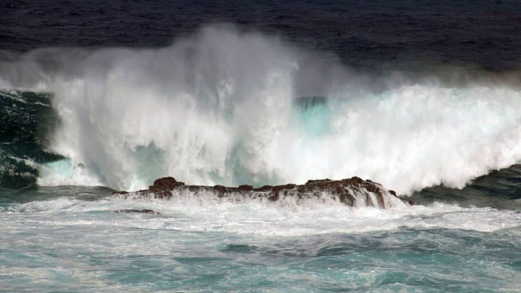
The National Weather Service issued a minor coastal flood statement and a high surf advisory effective at noon on December 4 for north and west facing shores of Kauaʻi and Niʻihau, warning of large breaking waves and possible isolated coastal flooding. Forecasters forecast surf of 10 to 16 feet with localized higher sets, and noted that peak monthly tides running higher than predicted could push water into shorelines and low lying roadways. Vulnerable docks, boat ramps, coastal roads and beach access areas were identified as at risk for brief inundation and some coastal erosion.
Local authorities and ocean safety officials urged precautions for residents and businesses that use shoreline access points. Advisories recommended avoiding driving through flooded roadways, moving valuables and vehicles to higher ground, securing canoes and watercraft, and monitoring vessel moorings. Officials emphasized marine safety with a simple safety directive, "when in doubt, don’t go out." By December 6 surf levels had declined to just below advisory thresholds and the high surf advisory was cancelled for some areas, though a threat of minor coastal flooding persisted during morning high tides.
The episode carries economic implications for Kauaʻi, where coastal infrastructure supports fishing, recreational boating and tourism. Short term impacts can include temporary closures of beaches and boat ramps, lost visitor activity during advisories, and repair costs for eroded shorelines and damaged facilities. Repeated events of this type also inform longer run budget and insurance pressures for county and private owners, and increase the case for targeted investments in shoreline hardening, elevation projects and managed retreat where appropriate.

Community monitoring played a supporting role with coordination from the University of Hawaiʻi Sea Grant King Tides Project, which collected community submitted photos and observations to document inundation footprints. Those local observations provide useful empirical evidence for emergency managers and planners assessing which roads and coastal assets are most vulnerable. The December 4 to 6 event is a reminder that residents and businesses should keep preparedness plans current, track tide forecasts during monthly high tide cycles, and support local resilience efforts to reduce future economic and infrastructure risk.
Sources:
Know something we missed? Have a correction or additional information?
Submit a Tip