Investigation Links Rising Floods to Moisture Shift, Warmer Gulf Waters
A Washington Post data driven investigation updated November 12, 2025 ties more frequent and intense flooding in central Appalachia to shifts in atmospheric moisture transport and warmer Gulf of Mexico sea surface temperatures, findings that directly implicate McDowell County. The analysis documents increased heavy rain days and maps that place much of the county in high risk flood zones, underscoring urgent needs for local resilience planning, funding, and coordinated recovery efforts.
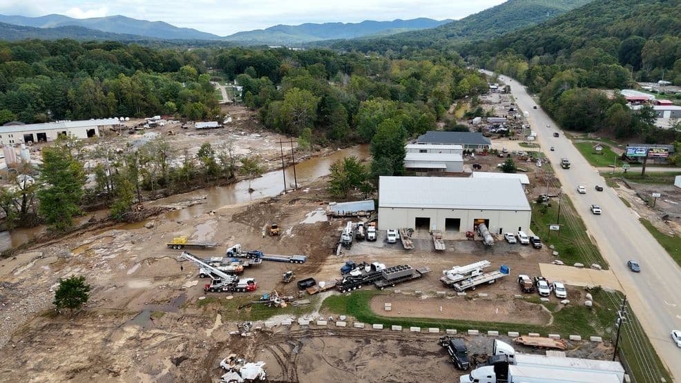
The Washington Post investigation released November 12, 2025 draws a direct line between changing atmospheric dynamics and the recent catastrophic floods that struck McDowell County. Using observational datasets and model output, reporters and analysts connect intensified moisture plumes from the Gulf of Mexico, measured as integrated vapor transport or IVT, with a long term rise in extreme precipitation across central Appalachia. For McDowell County the pattern is not theoretical. The county experienced rapid river rises during the February 2025 flood that swamped Welch city hall, the public library, and the sheriff's station, while roads and bridges across the county were damaged and multiple local lives were lost.
The Post analyzed 75 years of rain gauge records across central Appalachia and found a roughly 35 percent increase in heavy rain days, about two more heavy rain days per year since the mid 20th century. That trend amplifies the chance that individual storms, particularly moisture rich plumes driven from the Gulf of Mexico, will produce damaging rainfall over short periods. NOAA and ECMWF datasets were used alongside flood risk analyses to show where those moisture routes and precipitation increases translate into heightened local exposure.
For residents of McDowell County the investigation reinforces assessments by FEMA and West Virginia University researchers that much of the county sits in high risk flood zones. Those maps and analyses confirm what local officials and first responders saw on the ground in February when critical municipal infrastructure was inundated and transportation links were severed. The Post notes that the story links to local reporting for specific casualty details, reflecting the human toll that accompanies statistical trends.
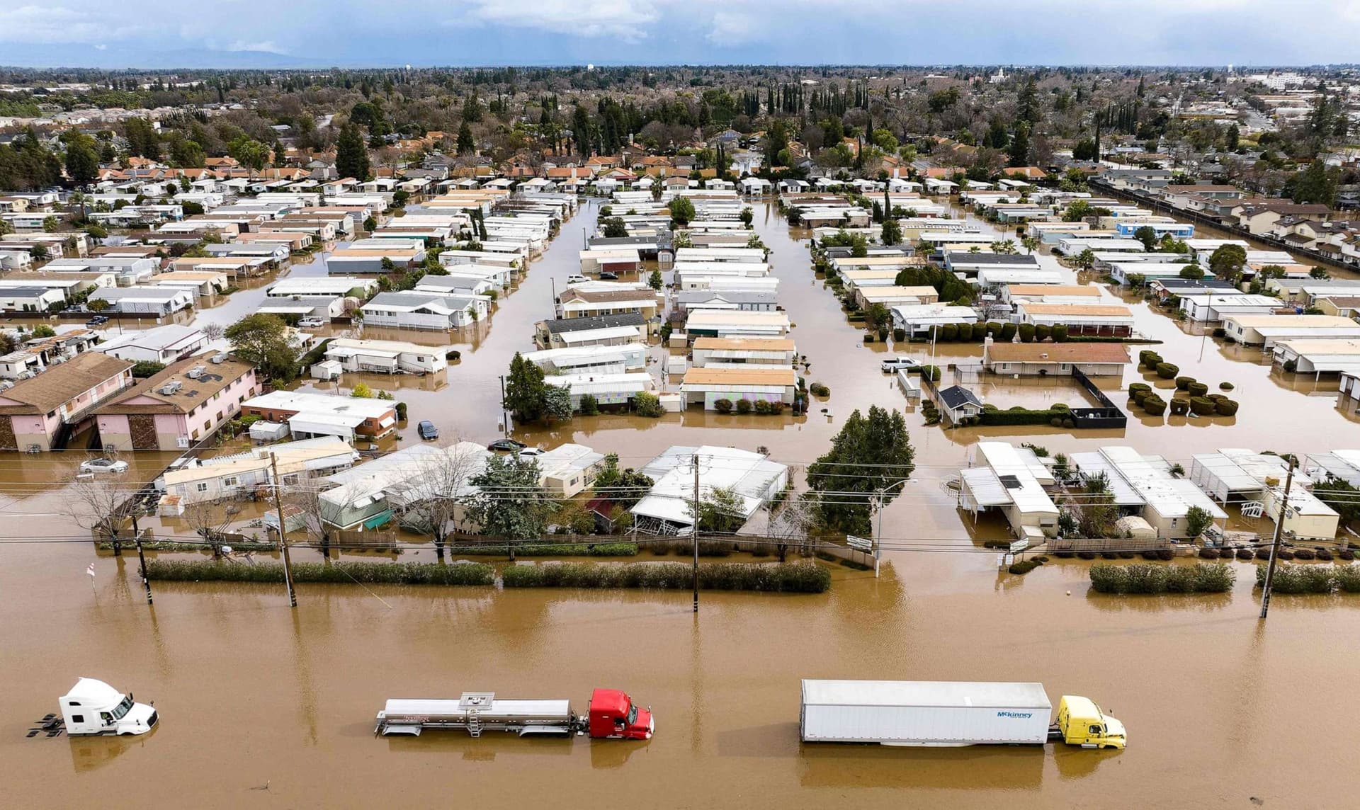
The reporting frames floods as a compound problem of climate driven shifts in precipitation and longstanding social and institutional vulnerabilities. Housing and public buildings in flood plains, aging transportation and drainage infrastructure, and limited local financial capacity to invest in mitigation and recovery increase both exposure and long term risk. Low income and infrastructure poor communities are disproportionately affected, which raises questions about equitable allocation of state and federal resilience funds and the design of mitigation programs that can reach the most impacted places.
Policy implications for McDowell County are clear and immediate. The trends identified by the Post suggest a higher likelihood of repeated severe events, which calls for scalable resilience measures, prioritized investment in critical infrastructure, and updated land use planning that accounts for evolving flood risk. Coordination among county leaders, state agencies, FEMA, and academic partners will be essential to secure funding and technical assistance. For voters and civic stakeholders, the investigation offers data driven context to guide advocacy on spending priorities and long term recovery decisions that will shape the county's future safety and economic stability.