Pacific Storm Brought Rain, Snow and Travel Hazards to McKinley County
A Pacific storm system moved into New Mexico on November 19, 2025 bringing scattered showers and thunderstorms across the state and high elevation snow to northern mountain passes. The system affected Gallup and western McKinley County, creating wet road conditions and raising travel safety concerns for residents along Interstate 40 and surrounding highways.

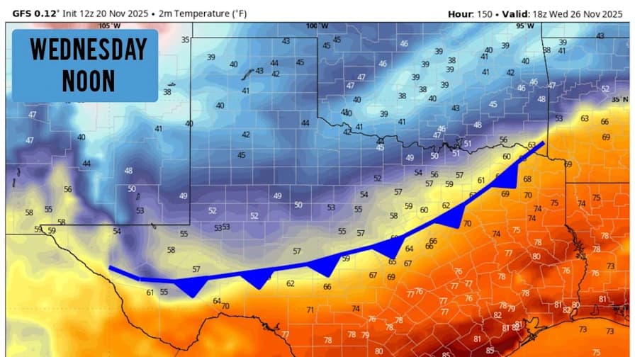
A Pacific storm system that moved into New Mexico on November 19, 2025 produced scattered showers and isolated thunderstorms across much of the state, with high elevation snow in northern mountain areas, according to KOAT Action 7 News. Chief Meteorologist Byron Morton and the KOAT weather team warned that the corridor along Interstate 40, including Gallup and Grants, would see showers and the potential for localized heavy precipitation. The briefing outlined timing for showers through the evening, a brief break on Friday, and the forecasted arrival of another system over the weekend.
The most immediate impacts for McKinley County were wet and potentially slick roads, reduced visibility during heavier downpours, and the chance of snow accumulation at higher elevations. KOAT forecast maps indicated that some mountain areas could receive four to eight inches of snow or more, with higher impact on travel where elevation drives weather. The report also highlighted localized severe storm risks in parts of southern and central New Mexico, underscoring that thunderstorms can generate hail, gusty winds, and rapid changes in road conditions.
For Gallup and western McKinley County, the storm passage meant scattered showers and thunderstorms as the system moved through the region. KOAT advised residents to monitor localized forecasts for road and travel conditions on Interstate 40 and adjacent highways. Those updates are especially relevant for commercial carriers, school transportation planners, and residents who commute across the county, because timing and intensity of showers can change driving conditions quickly.
The timing noted by KOAT carried implications for short term planning. The forecasted break on Friday offered a temporary easing of travel risk, but the subsequent system expected over the weekend suggested the need for continued vigilance. Weather briefings with maps and timing served as the primary public guidance in this episode, and they illustrate the role of broadcast meteorology in informing county residents and local agencies during multi day storm sequences.
Local leaders and transportation authorities rely on these forecasts to coordinate responses, manage road crews, and issue travel advisories. For McKinley County residents, the practical takeaway is to check updated forecasts before travel, allow extra time for trips on Interstate 40 and other routes, and prepare for variable conditions at higher elevations. Continued attention to county and state travel advisories will be critical if the weekend system produced renewed precipitation or snowfall in the days following November 19, 2025.


