Prince George's County Showcases Connected Multiuse Trails and Greenways
Prince George's County offers an extensive network of paved multiuse trails and stream valley greenways that link parks, the University of Maryland campus, neighborhoods and transit hubs. These connections expand accessible options for walking, running and cycling, supporting recreation, commuting and local economic value for residents.
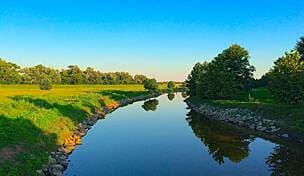
Prince George's County has a connected system of paved multiuse trails and stream valley greenways that serve as a backbone for outdoor recreation and active transportation across the jurisdiction. Key routes include the Paint Branch Trail, which links Lake Artemesia to Cherry Hill Road and College Park and integrates with other local corridors. The Indian Creek Trail connects Lake Artemesia to Greenbelt Road. The Northeast Branch and Northwest Branch trails form part of the broader Anacostia Tributary Trail System. Local connectors around Lake Artemesia and the Trolley Trail further knit parks, the University of Maryland campus, neighborhood green space and several transit hubs together.
For residents this network matters because it creates low cost, car free options for short trips and daily exercise. The paved, multiuse design accommodates walkers, runners and cyclists, broadening access for families and commuters who rely on transit at hubs linked by these trails. As pedestrian and bicycle routes that connect to education and employment centers, the trails contribute to livability and can reduce local vehicle miles traveled when commuters choose bike or walk for first mile and last mile connections.
From an economic perspective, connected trail systems tend to support nearby property values, local business foot traffic and municipal goals for health and sustainability. The stream valley greenways also provide natural stormwater corridors and recreational open space that are valuable in planning for resilient neighborhoods. The presence of trails near the University of Maryland boosts campus access and student mobility without increasing parking pressure.

Residents planning walks or rides can use TrailLink, Maryland National Capital Park and Planning Commission materials and local trail maps as starting points for route information and conditions. For county leaders, maintaining pavement quality, signage and safe crossings at road intersections will be critical to convert recreational use into reliable transportation options. Continued investment in connections between neighborhoods, transit and key destinations will increase the economic and health returns of the trail network over the long term, while preserving the county's green corridors for future generations.