Renewed winter trail network secures North Slope supply lifeline
A renewed BLM right-of-way extends the Community Winter Access Trail, ensuring seasonal overland deliveries and emergency access across North Slope villages.
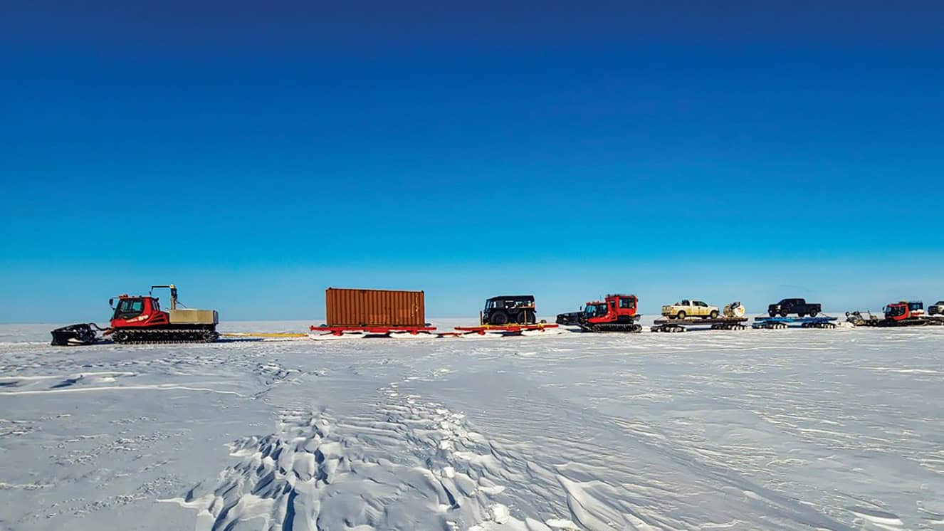
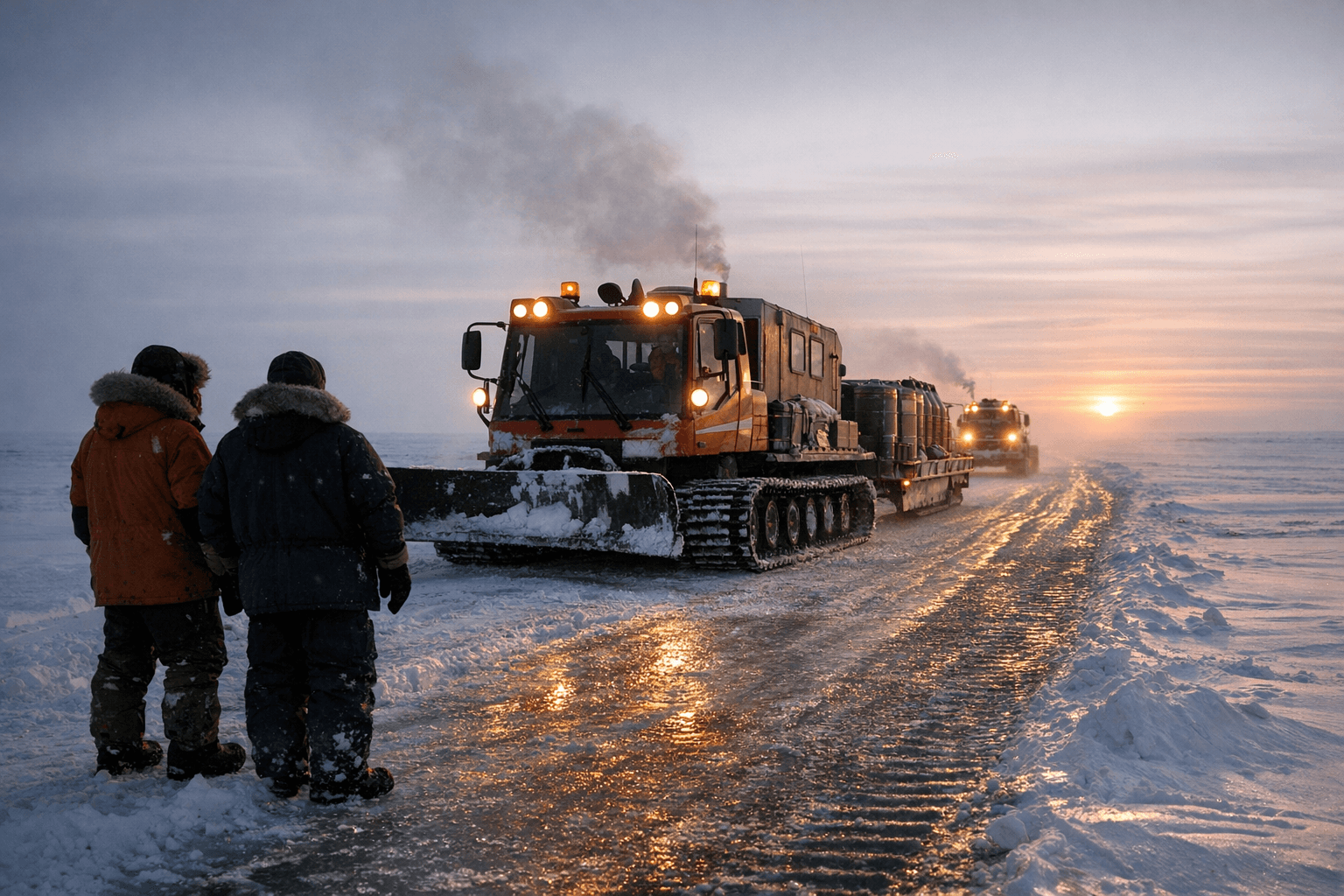
The Community Winter Access Trail, a seasonal compacted-snow overland network, continues to underpin winter life on the North Slope after a Bureau of Land Management right-of-way was renewed to extend operations. Built each season with low-ground-pressure equipment, the trail links Prudhoe Bay, Utqiaġvik, Wainwright, Atqasuk and Anaktuvuk Pass and provides a critical alternative when sea ice and air service are constrained.
The trail is not permanent infrastructure in the conventional sense. Crews construct and maintain the route anew each winter, compacting snow and following alignments that reflect traditional tundra travel while accommodating modern freight needs. Low-ground-pressure machines are used to reduce tundra impact, and operators report coordination with local governments, federal agencies and regional corporations to schedule use, supply runs and escorted private-car caravans. The result is a flexible logistics corridor that supports fuel deliveries, freight convoys and emergency movement across long distances where other modes are seasonal or disrupted.
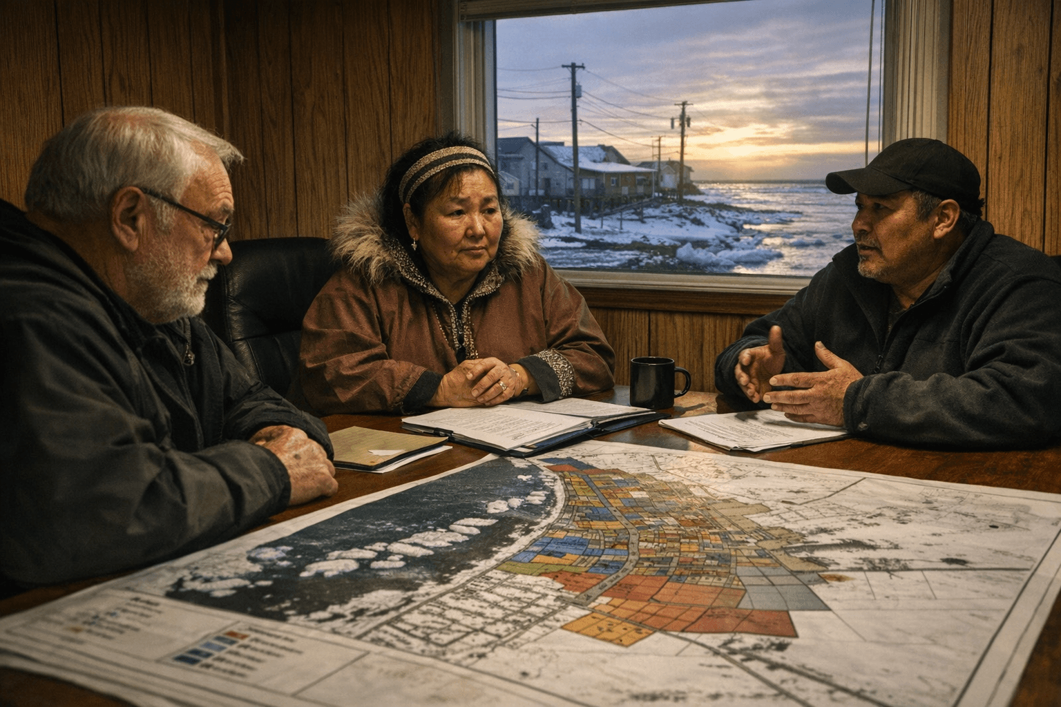
Institutionally the program sits at the intersection of federal permitting, borough planning and corporate logistics. The BLM right-of-way provides the legal framework for seasonal crossings of federal lands; local government bodies and tribal councils coordinate village-level operations and safety escorts; regional corporations and private contractors supply equipment and funding for construction. That multi-party arrangement has strengths in shared responsibility, but it also creates friction points. Permitting timelines, funding uncertainties and the need for documented environmental monitoring complicate planning and raise the risk of seasonal delays.
For residents the effects are tangible. When the trail is operable, communities see more reliable fuel and grocery deliveries, improved options for patient transport and better capacity for large-equipment moves that would otherwise come by air or sea. In emergency scenarios, the network can mean the difference between timely ground evacuation or prolonged isolation. At the same time, protecting subsistence use and minimizing tundra damage are ongoing priorities, requiring season-by-season discipline in alignment, construction techniques and post-season assessments.
Policy implications are straightforward. Stable funding lines and clearer, predictable permitting schedules would improve logistics planning and reduce operational gaps. Formalized environmental monitoring and public reporting would strengthen trust among residents who rely on the trail while safeguarding tundra resources. Local governments, federal agencies and corporations will need durable agreements that balance supply reliability with environmental stewardship and subsistence rights.
The takeaway? The CWAT is a practical, place-specific solution that blends old routes and modern logistics to keep communities fed, fueled and connected in tough winters. Our two cents? Watch borough and tribal meetings where trail permits and budgets are discussed, ask for published monitoring results, and plan winter deliveries knowing the trail is a seasonal but essential part of North Slope resilience.
Sources:
Know something we missed? Have a correction or additional information?
Submit a Tip
%3Aquality(70)%2Fcloudfront-us-east-1.images.arcpublishing.com%2Fadn%2FI5ENYIGHINDLDHJTFIEJJQUS4I.jpg&w=1920&q=75)