Rockwall County namesake formation explained, what residents should know
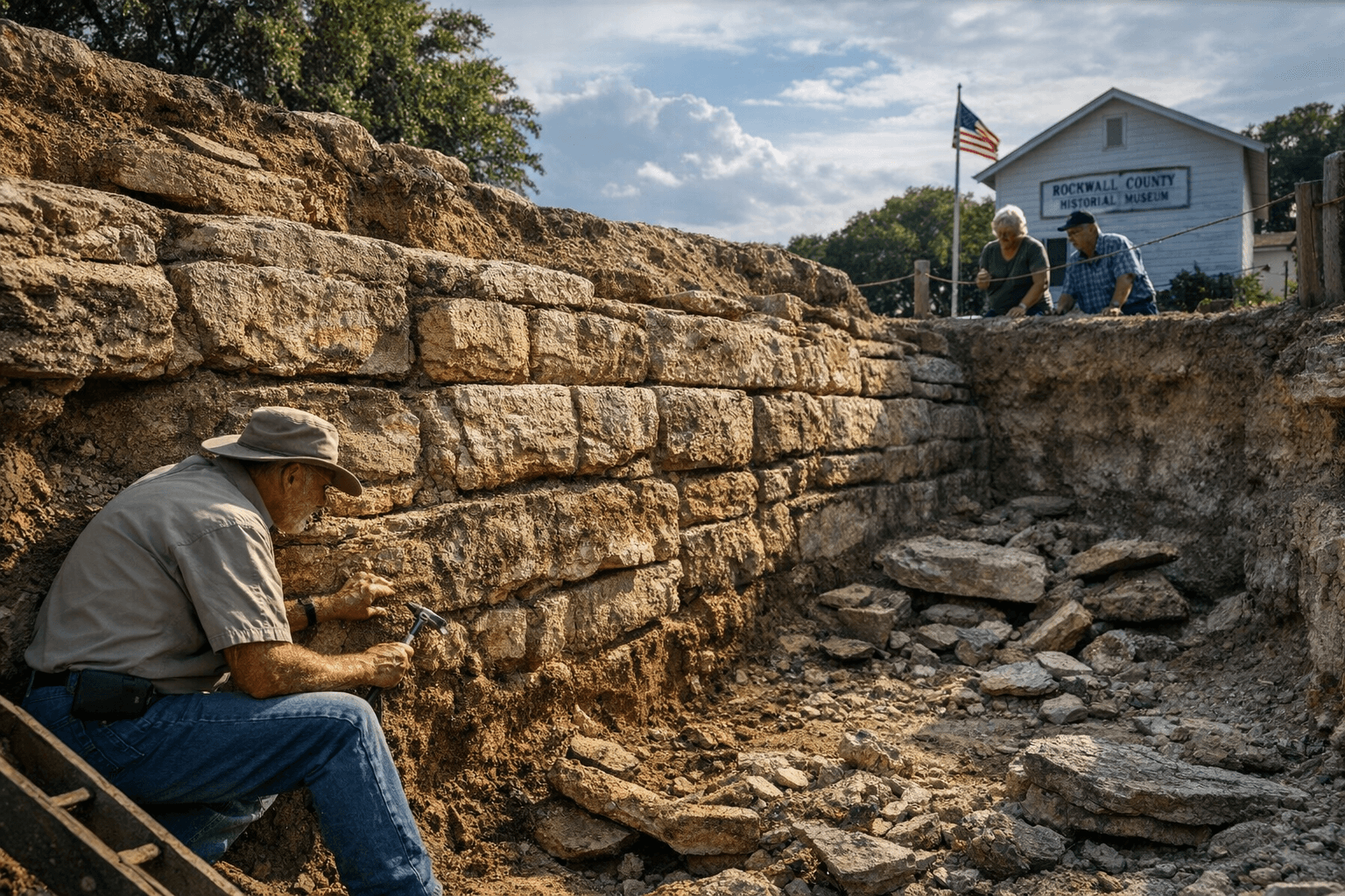
The underground Rock Wall formation, uncovered by early settlers digging wells in the mid 1800s, was long thought to be a man made wall but later geological study identified the feature as natural sandstone or clastic sand dikes. Portions have been excavated and displayed at the county museum and the historic courthouse, while much of the formation remains on private land, raising questions about preservation, access and local benefit.

The linear sandstone outcroppings that gave Rockwall its name have shaped local identity for more than a century. Discovered by settlers in the mid 1800s as they dug wells, the formations were initially interpreted as an ancient man made wall. Subsequent investigations through the 19th and 20th centuries including study by geologists such as Dr. Robert T. Hill concluded the features are natural, classifying them as sandstone dikes or clastic sand dikes rather than built masonry.
Excavations and interpretive efforts have continued over time. Isolated segments of the formation were exposed and moved into public view at times. The Rockwall County Historical Foundation and the City of Rockwall have documented discovery sites, past digs and mapping efforts, and portions of the Rock Wall have been displayed at the county museum and in the historic courthouse. Many original in situ sections are on private property and are not open for public excavation or viewing.
For local residents the Rock Wall matters beyond curiosity about origins. It is a focal point for civic pride and local history, an asset for heritage tourism and a teaching tool for schools and community groups. At the same time the fact that key stretches lie on private land creates unequal access to those resources, and prompts questions about who benefits from preservation and interpretation. Decisions about excavation and display also carry practical concerns for landowners, municipal planners and public safety, since historic digs changed landscapes and modern work requires professional oversight.
Policy options for the city and county include strengthening partnerships between museums and landowners, negotiating easements or access agreements, expanding interpretive exhibits, and ensuring any future excavations meet contemporary standards for safety and environmental protection. Residents seeking to see exhibits or learn more can consult the county museum for current displays and programming at rockwallcountymuseum.com. As Rockwall balances stewardship of the formation with private property rights, the feature remains a tangible link between local geology and community history.
Sources:
Know something we missed? Have a correction or additional information?
Submit a Tip