San Francisco neighborhood primer: navigate transit, crowds and microclimates
Clear neighborhood profiles and practical transit tips for navigating San Francisco's varied districts.

San Francisco's neighborhoods operate like distinct small cities stacked into one municipality. Understanding where people gather, how transit moves, and which city agencies handle common issues matters for residents, commuters, small-business owners and visitors who rely on reliable travel, parking and public services.
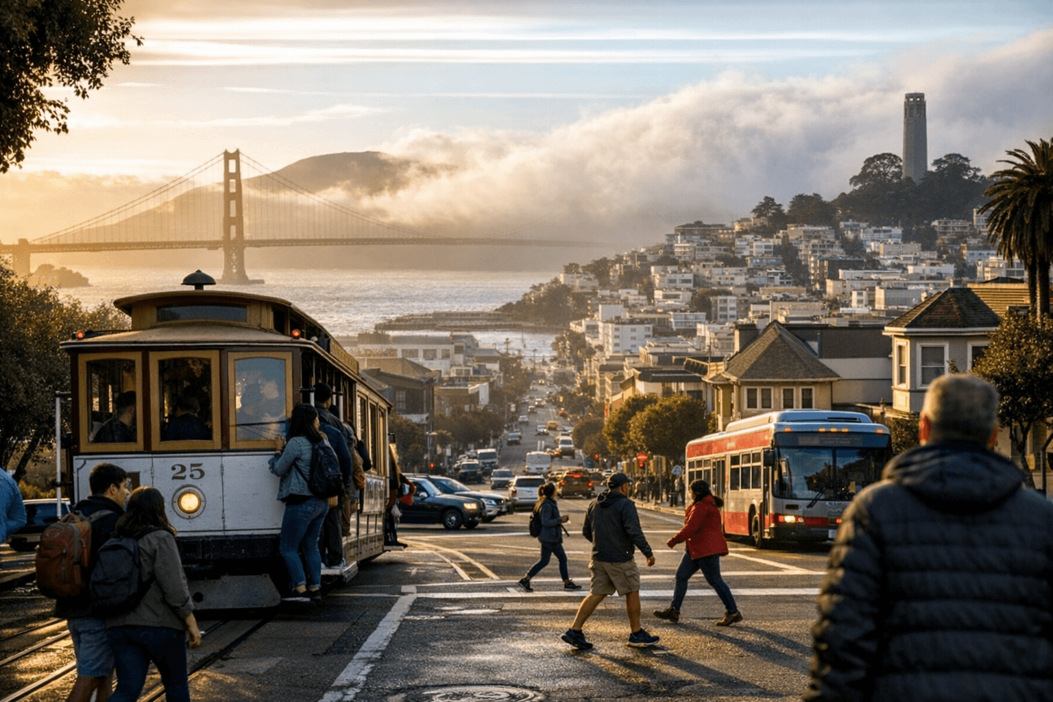
Downtown, the Financial District and Embarcadero concentrate high-rise offices, the Ferry Building and waterfront promenades. Expect heavy weekday foot traffic and strong transit service via BART and ferries; these corridors function as the city's primary commuter arteries. North Beach and Chinatown remain walkable dining and tourist clusters, with the busiest pedestrian flows around Columbus Avenue and Grant Avenue. The Mission centers on restaurants, murals and nightlife with Valencia and Mission streets serving as hubs for evening and weekend activity. Haight-Ashbury retains counterculture history and vintage retail with direct access to Golden Gate Park, while the Castro continues as a cultural nexus for LGBTQ+ history, theaters and eateries. Richmond and Sunset are quieter, family-oriented neighborhoods near Golden Gate Park and Ocean Beach.
Transit choices shape daily life: Muni, ferry routes and BART provide the backbone for most trips across neighborhoods. Frequent commuters should use a Clipper card or contactless payments to speed boarding and transfers. Plan extra travel time during commute hours when downtown and transit hubs see concentrated demand. Parking remains uneven across the city; metered zones and residential permit restrictions are common and affect both short visits and overnight parking.
Institutional roles matter for practical problems and policy trade-offs. SFMTA manages transit planning and parking regulation that balance congestion, revenue and neighborhood livability. SF311 is the route for non-emergency city services, while sfrecpark.org governs parks programming and community center offerings that shape neighborhood life. Local neighborhood merchant associations play a steady role coordinating small-business hours, street-level events and communications with city agencies; their capacity influences how quickly shops adapt to tourism peaks or street closures.
The neighborhood differences have policy implications for equity and civic engagement. Transit reliability in high-traffic districts determines commuter access to jobs; parking permit policies affect residents' cost of living and visitors' ability to patronize local businesses; park programming steers where families and older residents spend time. Civic engagement through neighborhood associations and community centers directly affects service priorities and event planning at the block level.
The takeaway? Dress in layers for microclimates, carry a Clipper card, and check SFMTA, SF311 or sfrecpark.org before you travel. If you care about how your neighborhood shares street space and transit service, get involved with your merchant association or local community center—small steps at the neighborhood level can shape citywide outcomes.
Know something we missed? Have a correction or additional information?
Submit a Tip