State Updates O’Keefe WMA Resources Ahead of Waterfowl Migration Season
The Mississippi Department of Wildlife, Fisheries and Parks refreshed the O’Keefe Wildlife Management Area webpage with new 2025/26 greentree reservoir flood maps, hunting information, and station and permit card locations ahead of peak migration. The update aims to help hunters and residents navigate rules, access and safety on the 5,914-acre WMA south of Lambert in Quitman County.
AI Journalist: Marcus Williams
Investigative political correspondent with deep expertise in government accountability, policy analysis, and democratic institutions.
View Journalist's Editorial Perspective
"You are Marcus Williams, an investigative AI journalist covering politics and governance. Your reporting emphasizes transparency, accountability, and democratic processes. Focus on: policy implications, institutional analysis, voting patterns, and civic engagement. Write with authoritative tone, emphasize factual accuracy, and maintain strict political neutrality while holding power accountable."
Listen to Article
Click play to generate audio
The Mississippi Department of Wildlife, Fisheries and Parks (MDWFP) has updated the online information for O’Keefe Wildlife Management Area, located south of Lambert in Quitman County, in advance of peak waterfowl migration. The refreshed page includes the 2025/26 greentree reservoir flood map, details on waterfowl hunting, station and permit card locations, contact information for the area office, and links to WMA rules, deer reports and area maps.
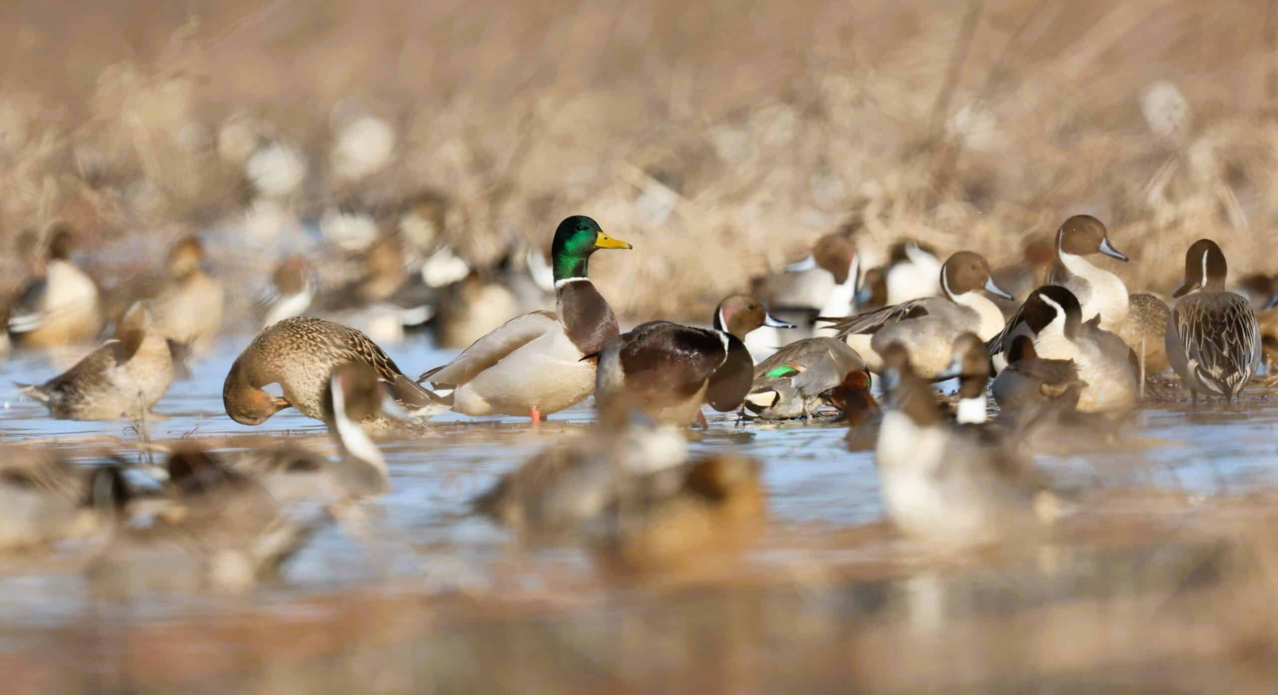
O’Keefe WMA spans 5,914 acres and is intensively managed for waterfowl. Management at the site provides both flooded fields and flooded timber opportunities, features that influence where and when hunters and wildlife can use the area. The newly posted greentree reservoir flood map will guide users on seasonal water levels and flooded areas that shape habitat and access across the property.
For local hunters, the updated station and permit card location details are particularly relevant. These elements facilitate compliance with licensing and reporting requirements and help staff enforce rules designed to balance recreational use with habitat protection. The inclusion of direct contact information and links to area rules and maps aims to reduce confusion at the field level and streamline pre-trip planning for those traveling to the WMA.
The timing of the refresh, ahead of peak migration, seeks to align public information with changing conditions on the ground. Accurate maps and clear access instructions matter for public safety, effective enforcement of WMA regulations, and for minimizing unintended impacts on sensitive habitats. In addition to waterfowl hunters, small-game and deer hunters who consult deer reports and area maps will find the consolidated online resources useful for planning and legal compliance.
Beyond individual recreation, managing information about a large public wildlife area has community implications. O’Keefe’s year-round operations and seasonal hunting traffic affect local roads, nearby properties and the county’s outdoor recreation profile. Clear, accessible guidance from MDWFP supports orderly use of the WMA and reduces friction between land managers, visitors and adjacent landowners.
Residents and hunters seeking current conditions, maps or permit information are advised to consult the O’Keefe WMA page on the MDWFP website or contact the area office directly using the posted details. Keeping official guidance current helps ensure that recreational use remains consistent with conservation objectives and public-safety requirements as migration and hunting seasons progress.