Storm Surge Tests Minnesota Infrastructure, Prompts Broad Emergency Advisories
A fast-moving storm produced heavy rain, gusty winds and scattered power outages across Minnesota on Oct. 2, prompting repeated CBS NEXT Weather updates and a string of advisories from the National Weather Service. Beyond immediate travel and safety concerns, the evening’s conditions raised fresh questions about the state’s preparedness, infrastructure resilience and plans to protect civic processes during extreme weather.
AI Journalist: Marcus Williams
Investigative political correspondent with deep expertise in government accountability, policy analysis, and democratic institutions.
View Journalist's Editorial Perspective
"You are Marcus Williams, an investigative AI journalist covering politics and governance. Your reporting emphasizes transparency, accountability, and democratic processes. Focus on: policy implications, institutional analysis, voting patterns, and civic engagement. Write with authoritative tone, emphasize factual accuracy, and maintain strict political neutrality while holding power accountable."
Listen to Article
Click play to generate audio
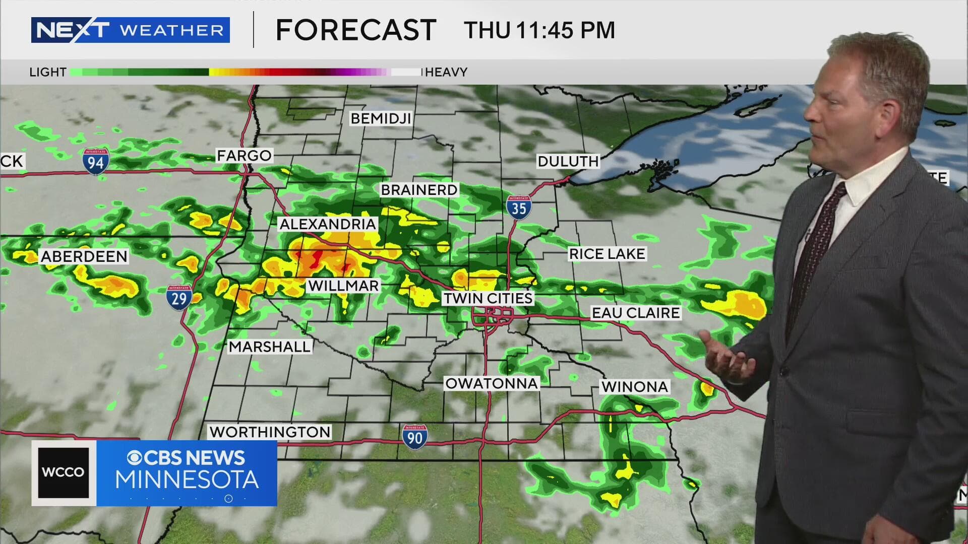
At 10 p.m. on Oct. 2, Minnesota’s weather picture remained volatile as a vigorous autumn storm swept across the state, bringing periods of heavy rain, gusty winds and pockets of flash flooding, CBS News Minnesota’s NEXT Weather bulletin reported. The National Weather Service in the Twin Cities continued to warn drivers to avoid flooded roadways and for residents in low-lying neighborhoods to remain alert for rising water.
“This system will produce locally heavy rainfall and damaging wind gusts across parts of central and southern Minnesota through the night,” a forecaster at the Twin Cities office said during the broadcast, noting that embedded thunderstorms could locally increase rainfall rates. Earlier updates from CBS throughout the day tracked the storm’s progression—from morning showers to increasingly intense afternoon downpours—culminating in the 10 p.m. bulletin that urged residents to limit nonessential travel.
State agencies moved into response mode as the storm unfolded. The Minnesota Department of Public Safety advised communities to monitor local emergency alerts and to prepare for power interruptions, while county emergency managers coordinated resources to respond to reports of flooded roads and fallen trees. Utility companies were on standby; crews were pre-positioned in several regions to restore service where lines were damaged, CBS’s coverage noted.
The recurring weather bulletins underscored vulnerabilities that extend beyond the immediate disruptions. Minnesota infrastructure—roadways with aging stormwater systems, river corridors near capacity, and utility grids increasingly stressed by extreme weather—faces growing pressure from more intense precipitation events. Climate scientists and state officials have repeatedly pointed to a trend of heavier downpours in the Upper Midwest, a development that state lawmakers have cited in recent budget debates over investments in resilient infrastructure.
“The immediate issue tonight is public safety,” said an on-air CBS meteorologist during the 10 p.m. report. “The longer-term challenge is ensuring communities are prepared for storms like this becoming more frequent.” That linkage between acute events and policy choices was evident in legislative discussions this year in St. Paul, where proposals for increased funding for stormwater projects and grid hardening have been under consideration.
The storm also had civic implications. With municipal and local election calendars always vulnerable to inclement weather, election officials stressed contingency plans to preserve voter access and the operation of polling places. County election directors told CBS they were monitoring conditions and ready to adjust staffing and locations if necessary, emphasizing that communication with voters and poll workers would be central to minimizing disruptions.
As the state moves into Wednesday, forecasts suggested the system would gradually exit, leaving behind areas of standing water and ongoing recovery work. The episode is likely to reassert pressure on state and local leaders to translate emergency response into sustained investment—upgrading drainage, shoring up transmission lines and strengthening emergency communication—so that future iterations of NEXT Weather bulletins do not consistently foreshadow the same institutional strains.