Updated Winter Forecast Brings Wind And Temperature Swings
The National Weather Service updated the Sterling point forecast and local conditions for Logan County, with the page showing a last update timestamp of 8:51 pm MST on December 3, 2025. Current observations posted early December 4 show overcast skies and temperatures in the upper 20s to low 30s F, and the short term outlook calls for a cold night followed by milder, breezy conditions through next week that could affect travel, outdoor events, and vulnerable residents.
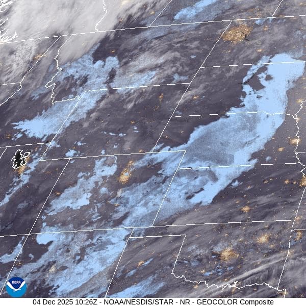
The National Weather Service issued an updated point forecast and local conditions for Sterling and Logan County late on December 3, 2025, with the page showing a last update time of 8:51 pm MST. The forecast page also carried a current conditions posting with a timestamp of December 4, 01:55 am MST, reporting Sterling Municipal Airport observations of overcast skies, temperatures in the upper 20s to low 30s F, and light southerly winds.
Short term forecasts valid from December 4 through December 10 outline a crisp Thursday with sunshine and a high near 42 F, and west southwest winds of 8 to 13 miles per hour with gusts up to about 22 miles per hour. Forecasters note that wind chill values could drop to near or below zero in the coldest spots overnight. Friday and Saturday are expected to be mostly to partly sunny with highs in the mid 40s, and there is a slight chance of rain or snow late Saturday with breezy conditions. Sunday through Tuesday are forecast to be mostly sunny and generally milder, with highs rising into the upper 40s and possibly into the mid to upper 50s at times, while breezy periods are likely.
The update is practical for event planners, emergency services, school districts, and residents arranging weekend travel or outdoor holiday activities. The NWS page includes links to the detailed zone forecast for Logan County, a forecast discussion, printable forecasts, hourly tabular forecasts, active alerts, and road condition resources. Those tools are intended to help public safety officials calibrate road treatments, ambulance and fire response plans, and shelter operations.

Public health and equity concerns are central in this pattern of short lived cold followed by rapid moderation. Overnight wind chill near or below zero increases the risk of hypothermia for people experiencing homelessness, for older adults on fixed incomes who may keep homes colder to save on heating, and for outdoor workers. The chance of mixed precipitation late Saturday could complicate travel for rural residents who rely on two lane roads. Local agencies and community groups should use the official forecast and road resources to coordinate warming centers, check on medically vulnerable neighbors, and plan safe routes for holiday travel.