Weekend Arctic Front Threatened Snow, Disrupted Baltimore Area Travel
A fast moving clipper system and Arctic front moved through late Saturday night into early Sunday, and forecasters warned it could produce accumulating snow and slick roads across the Baltimore region. The forecast called for around three to four inches in some locations but noted uncertainty about exact amounts and whether precipitation would fall as snow or mixed forms, making travel conditions unpredictable for residents.
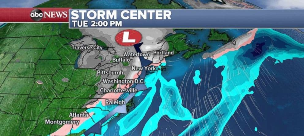
Forecasters issued warnings on Friday that a fast moving clipper system combined with an Arctic front could bring accumulating snow to the Baltimore region late Saturday night into early Sunday. Forecasts as of Friday projected around three to four inches of snow in some areas, but they emphasized uncertainty about exact totals and precipitation type, complicating planning for residents and agencies.
Timing for the system placed initial precipitation Saturday evening in western parts of Maryland with a steady eastward push overnight. The heaviest precipitation was likely overnight and into early Sunday. Those timing projections raised concerns about overnight commuting and Sunday morning travel, when visibility and road surface conditions can degrade rapidly under freezing temperatures and precipitation.
Local institutional actors publicly played central roles in preparedness and response. The National Weather Service provided ongoing forecast updates and advisories, while the Baltimore City Department of Transportation monitored road conditions and logistics for snow clearing and treatment. Officials advised residents to follow National Weather Service forecasts and Department of Transportation updates, and to prepare for possible slick roads and reduced visibility.
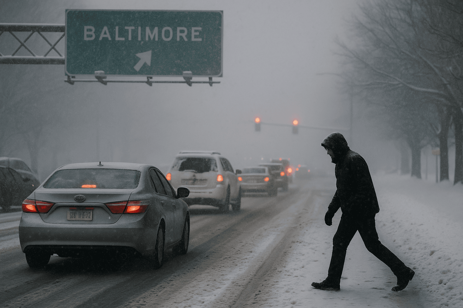
For Baltimore residents the practical impacts included increased risk for evening and early morning travel, potential delays or hazardous conditions for buses and other transit, and the need for individual preparations such as allowing extra travel time and securing supplies for brief disruptions. The uncertainty in precipitation type also meant that some neighborhoods could see rain or sleet instead of snow, producing mixed surface conditions that complicate driving and public safety responses.
The episode highlights how short lead time systems can strain planning and resource allocation for city services, and how accurate, timely communication from meteorological and transportation authorities matters for household decisions. Residents are advised to continue monitoring official updates for follow up information on road conditions and any further advisories.
Sources:
Know something we missed? Have a correction or additional information?
Submit a Tip

