Boeing 777 9 Test Flight Creates Visible Contrails Over Humboldt County
A Boeing 777 9 test flight passed over Humboldt County on December 30, producing pronounced contrails that many residents photographed and posted to social media. The flight is part of Boeing testing ahead of planned commercial service in 2027, and the visible trails have prompted questions about aviation impacts, local noise and climate effects.
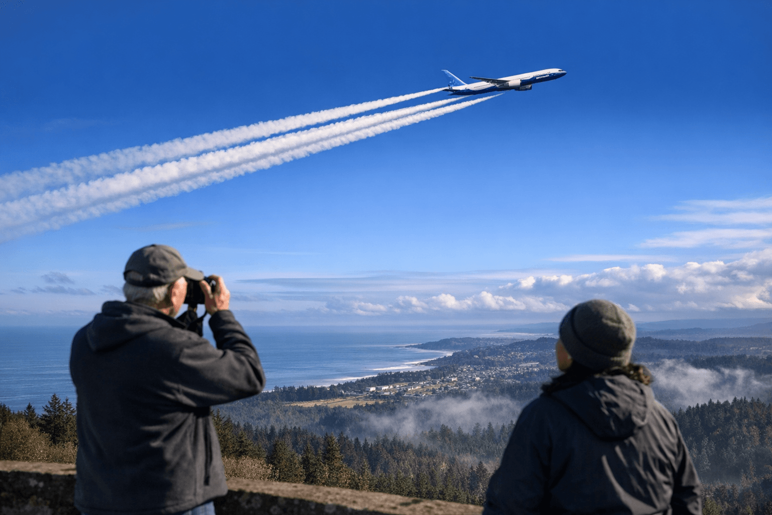
On December 30 a Boeing 777 9 test aircraft departed King County International Airport around 12 30 p.m. and flew down the Pacific coast before making multiple passes over Humboldt Bay and the stretch of coastline toward Coos Bay. The twin engine wide body jet cruised at speeds exceeding 500 miles per hour and operated at altitudes near 40 000 feet. The aircraft returned to Seattle shortly after 5 p.m.
The flight produced long looping contrails that formed striking ring and ribbon patterns in the sky. Many Humboldt County residents captured photographs and video of the phenomena and shared them on social media. The visible formations prompted speculation online about unusual emissions, while flight tracking data and aircraft identification linked the activity to Boeing test operations for the 777 9 program, which industry sources expect to enter commercial service in 2027.
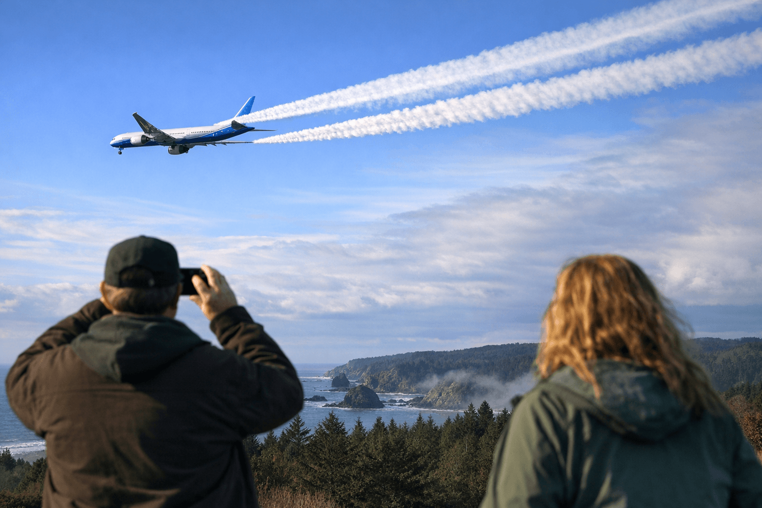
Contrails form when hot moist exhaust from jet engines meets very cold air at cruising altitudes. Water vapor condenses and freezes into ice crystals that can appear as thin streaks or broader cloudlike plumes depending on atmospheric conditions. At high altitudes around 40 000 feet the right combination of humidity and temperature can allow contrails to persist and spread, producing the kinds of looping shapes observed over Humboldt County.
The episode matters locally for several reasons. Flights originating from Boeing Field and other Puget Sound airports regularly use Pacific corridor routes for testing and certification. Those operations support aerospace jobs and suppliers across the region, including the North Coast supply chain and maintenance providers. At the same time visible test flights raise community concerns about noise and environmental impacts and fuel weather related speculation that can erode public trust.
From a policy perspective contrails are part of broader aviation climate issues. Commercial aviation contributes roughly two to three percent of global carbon dioxide emissions and contrails and other non carbon effects add to aviation s overall radiative forcing. Researchers and regulators are studying routing and altitude adjustments to reduce persistent contrail formation but those adjustments can involve trade offs in fuel burn and scheduling. FAA airspace coordination governs test flights and local officials can expect continued engagement on noise and environmental monitoring as aircraft testing ramps for new models.
For Humboldt County residents the December 30 flights were a vivid reminder of how distant manufacturing and testing decisions intersect with local skies. This article includes photos and an embedded video for readers who posted imagery or who want to review the aerial patterns witnessed during the test flight.
Sources:
Know something we missed? Have a correction or additional information?
Submit a Tip