LANL warns of drone interceptions over restricted airspace R-5101
Los Alamos National Laboratory detected unauthorized drones in restricted airspace and warns pilots they may be intercepted. Violators face civil and criminal penalties.

Los Alamos National Laboratory detected recent unauthorized unmanned aircraft system flights in its restricted airspace, including an FAA-designated additional No Drone Zone, and has reiterated that it will take action to protect the site and surrounding community. The Laboratory said it has operated a counter-UAS system in cooperation with the National Nuclear Security Administration and the Federal Aviation Administration since 2018 and that detections prompted the renewed public advisory.
Laboratory officials said the CUAS capability can detect and track UAS and, when a threat is judged to exist, can take measures to stop a device that could endanger people, property or sensitive operations. “The drone flying public should be reminded that all airspace over the Laboratory is protected against unauthorized drone or UAS flights,” said Unica Viramontes, Associate Laboratory Director for Defense Protection. “We can detect and track a UAS, and if it poses a threat, we have the ability to disrupt control of the system, seize or exercise control, confiscate, or use reasonable force to disable, damage or destroy the UAS.”
The warning matters to Los Alamos County residents because the Laboratory’s protected airspace - identified as R-5101 on FAA maps - sits over the Pajarito Plateau and close to neighborhoods, trails and recreation areas where hobbyist and commercial drone use has grown. While LANL officials say they do not want to interfere with legitimate flights, they stressed that pilots who cross into restricted zones do so at their own risk. “If you fly a drone over the Laboratory, knowing the legalities, you assume the risk for its loss. Before you fly, it is a pilot’s responsibility to know the Laboratory’s airspace restrictions. Maps are available from the Laboratory and the FAA.”
Federal authorities have defined a potential UAS threat in terms that underscore national security concerns and possible local consequences. The NNSA and FAA definition used by the Laboratory frames a threat as “the reasonable likelihood that an unmanned aircraft system or unmanned aircraft activity, if unabated, could inflict or otherwise cause physical harm to a person; inflict or otherwise cause damage to property or systems; interfere with the operational mission of a covered facility or asset; conduct unauthorized surveillance or reconnaissance; or result in unauthorized access to, or disclosure of, classified or otherwise lawfully protected information.”
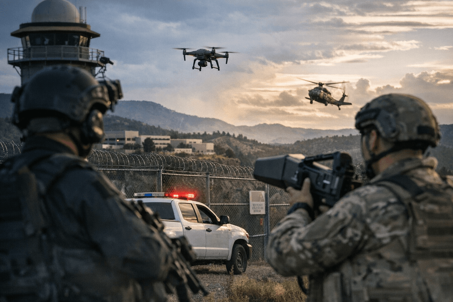
Pilots who violate these boundaries may face significant civil and criminal penalties. LANL said its authority to detect and track UAS is derived from federal law, and that signage marking no-fly boundaries has been developed in coordination with NNSA. The Laboratory also cautioned that, though collateral interceptions are a remote possibility, they could occur, so operators and residents should avoid flying near the Laboratory footprint.
The takeaway? If you fly a drone around Los Alamos County, check FAA and Laboratory maps first and keep well away from the R-5101 and additional No Drone Zone. Our two cents? Ground that quadcopter near town boundaries until you’re sure you’re clear of LANL airspace - it’s the safest bet for your craft and for the community.
Sources:
Know something we missed? Have a correction or additional information?
Submit a Tip