Multi-Day Winter Storm Threatens Park City and Summit County Ski Areas
Forecasters warn a multi-day storm will impact northern Utah beginning Saturday night and continue into Monday, bringing locally heavy snowfall in the Wasatch that could affect travel and resort operations in Summit County. Predicted accumulations range from a few inches in Park City town to more than a foot in nearby alpine canyons, and model ensembles point to an active pattern with additional systems possible next week.

Meteorologists are forecasting a staged winter storm for northern Utah that begins Saturday night, intensifies Sunday evening through Monday morning, and delivers a final burst as a cold front pushes through Monday. The multi-stage progression, laid out by meteorologist Adam Lenkowski, calls for an initial round of light mountain snow followed by heavier precipitation and a concluding surge tied to the frontal passage.
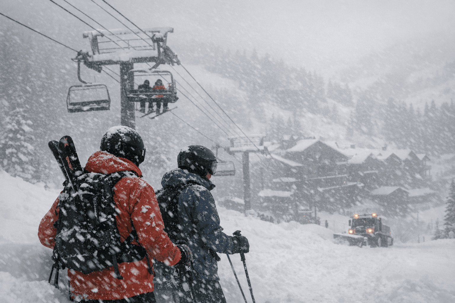
The Wasatch will see the heaviest totals. Forecast guidance highlights Cottonwood Canyons receiving 14 to 24 inches, with Deer Valley and Park City Mountain expecting 8 to 16 inches. Park City base and town are expected to pick up more modest accumulation, roughly 2 to 5 inches, with most town snow arriving Monday. Those distinctions matter for Summit County residents: deeper alpine totals will primarily affect higher-elevation ski operations and mountain travel, while town accumulations will influence local streets, parking and municipal services.
An active atmospheric pattern is expected to continue after this system. Ensemble model runs indicate additional storm systems could follow into the next week, increasing the probability of further accumulation across the region. That extended outlook raises questions about resource allocation and preparedness for public works, emergency services and ski-area operators as they respond to consecutive events.
Immediate practical impacts for Summit County include the potential for reduced visibility, snow-packed roads and slowed commutes, particularly on mountain approaches and service roads serving resorts. Heavier mountain snowfall can strain plowing operations and logistics for transit and emergency response; repeated storms can also complicate scheduling and supply chains for municipal maintenance. Ski areas are likely to see significant snow at upper elevations, which affects lift operations, grooming schedules and avalanche mitigation efforts, though specific resort decisions have not been announced.
Local officials and service providers will be the frontline institutions in managing consequences of persistent winter storms. Coordination among county public works, emergency management, transit agencies and resort operators will determine how quickly roads are cleared and services restored. For residents and visitors, the forecast underscores the need to monitor updates from local authorities, plan for travel delays and allow extra time for snow clearance and transit adjustments.
This multi-day event serves as a reminder that winter storms in the Wasatch can evolve in stages and that an active weather pattern can compound impacts across short timeframes. Summit County communities should expect challenging winter conditions through Monday with the potential for more snow in the days that follow.
Sources:
Know something we missed? Have a correction or additional information?
Submit a Tip