Owsley County Profile: History, Geography, Population, and Local Landmarks
Owsley County is a small, rural Appalachian county anchored by Booneville, its county seat, with a 2020 population of roughly 4,051. Understanding the county’s history, roads, waterways, and public lands matters to residents because those features shape daily life, local services, and opportunities for tourism and cultural preservation.

Owsley County traces its formal beginning to 1843, when the county was created and named for Governor William Owsley. Covering about 198 square miles in eastern Kentucky, the county lies in the Eastern Mountain Coal Fields and Appalachian Plateau region. Booneville serves as the county seat and the locus of local government and services for a population that ranked among the least populous in Kentucky in the 2020 census.
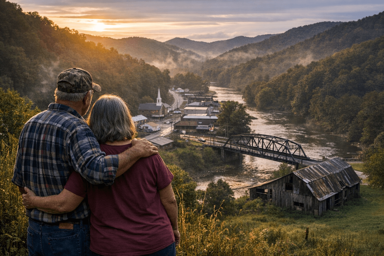
Geography defines much of Owsley County’s character and constraints. The South Fork of the Kentucky River runs through the county, threading valleys that support small communities and agricultural plots. Major highways KY-11 and KY-30 are the principal transportation arteries linking Booneville and other communities to neighboring counties and regional centers. For residents, those state routes are vital for access to markets, medical care, schools, and employment beyond county lines.
The county’s early settlement period and subsequent historical events have left visible marks. Courthouse fires are a recurring note in local history, having influenced where and how records were kept and shaping community memory of governance and law. Such events underscore the fragility of institutional infrastructure in small counties and the importance residents place on preserving historical artifacts and archives.
Public lands and cultural resources provide both conservation value and potential for local economic activity. Portions of Daniel Boone National Forest fall within Owsley County, offering woodland, wildlife habitat, and recreational opportunities that residents and visitors can use. Folk-art traditions and distinctive local craft features reflect a cultural continuity that remains an asset for community identity and could support modest heritage tourism.
Notable figures from Owsley County include Hall of Famer Earle Combs, whose legacy connects the county to broader American cultural history. Such associations offer points of pride for local residents and opportunities to celebrate regional heritage.
For Owsley County residents, the combination of low population density, rugged Appalachian terrain, limited but crucial road connections, river corridors, and publicly owned forest lands shapes everyday life. Local officials and community leaders continue to navigate the balance between preserving cultural and natural resources and expanding opportunities for services, connectivity, and economic resilience. Understanding these fundamentals helps residents and neighbors make informed decisions about infrastructure priorities, emergency planning, and cultural preservation as they look toward the coming decade.
Sources:
Know something we missed? Have a correction or additional information?
Submit a Tip