Light snow expected, temperatures to slowly climb in Morgan County
Forecasters warned that Morgan County would see another round of snow over the weekend even as temperatures eased slightly from an unusually cold week. The forecast and a temporary weather radio outage matter to commuters, emergency planners and residents who rely on timely alerts during winter travel.

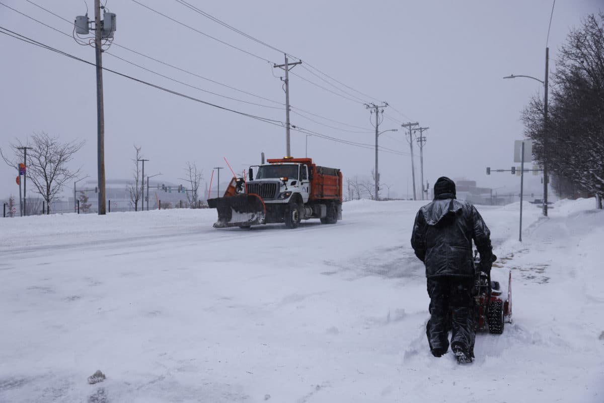
Forecasters on December 6 said Morgan County would begin to see lighter snow and a modest rise in temperatures after a week of subzero wind chills and record low readings. The National Weather Service forecast called for highs in the low 30s on Saturday and Sunday, with the snow beginning Saturday evening and peaking in the early hours of Sunday morning.
Meteorologist Chris Geelhart projected Jacksonville would receive about one inch of snow, with higher totals north of the city. AccuWeather forecasters projected one to three inches of snow and up to 0.15 of an inch of ice in parts of the region. The predictions were measured against last weekend's much heavier storm that dumped between 8.9 and 10.3 inches on the Jacksonville area, a storm that remains a benchmark for local winter preparedness.
Geelhart put the weekend system in context, saying "It's not terribly unusual, but it's better than it has been." He also noted how cold the county had been earlier in the week, saying "We had highs basically in the teens Thursday. That's a good 30 degrees below normal." Forecasters cautioned that while snowfall totals would be lower than the larger storm, slick spots would still develop on untreated surfaces. Geelhart urged motorists to take "extra caution" on the roads and to prepare for scattered icy patches, saying "Now that it's been around for a while, people should be kind of used to it, but there will be some scattered slick spots."

Local officials and residents should factor the forecast into travel and public service plans. Experts advised motorists to allow extra travel time and to carry an emergency kit with items such as a phone charger, warm clothing and extra food in case of delays or stranding. The National Weather Service also reported that its Springfield weather radio station would be off the air until Monday, and urged listeners to use alternate NOAA weather radio channels 162.525 in Jacksonville or 162.500 in Macomb for county coverage.
Temperatures are expected to climb further next week, potentially reaching the low 40s while still remaining below the mid forties typical for early December. For Morgan County officials the forecast underscores the need to balance routine winter operations with targeted outreach to vulnerable residents and travelers during the remainder of the cold snap.