Mid-January wintry mix brings gusty winds to Baltimore region
a mid-January cold front prompted warnings of a brief wintry mix and strong gusts across Baltimore and nearby counties, raising travel and public safety concerns.
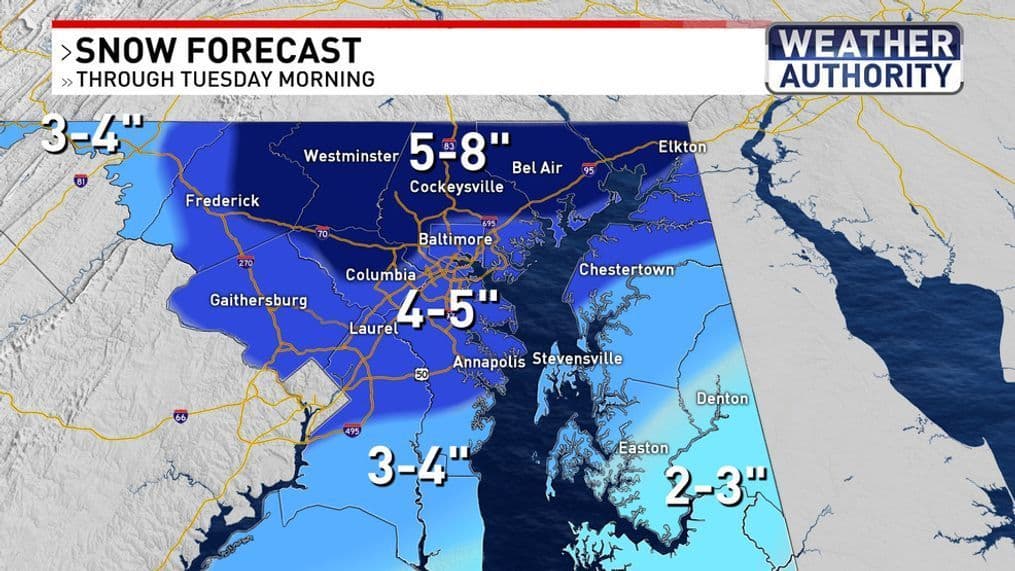
On Jan. 11 meteorologists issued a forecast warning that a secondary cold front could produce a brief wintry mix across parts of the Maryland region and bring breezy, gusty conditions. The update, posted at 8:49 AM EST that day, highlighted the possibility of a few flakes or sleet in areas including Westminster, portions of Baltimore County and Frederick County, while Garrett County faced a chance of minor snowfall accumulation. Gusts of 30 to 40 mph were expected in some spots, with cooler air arriving behind the system.
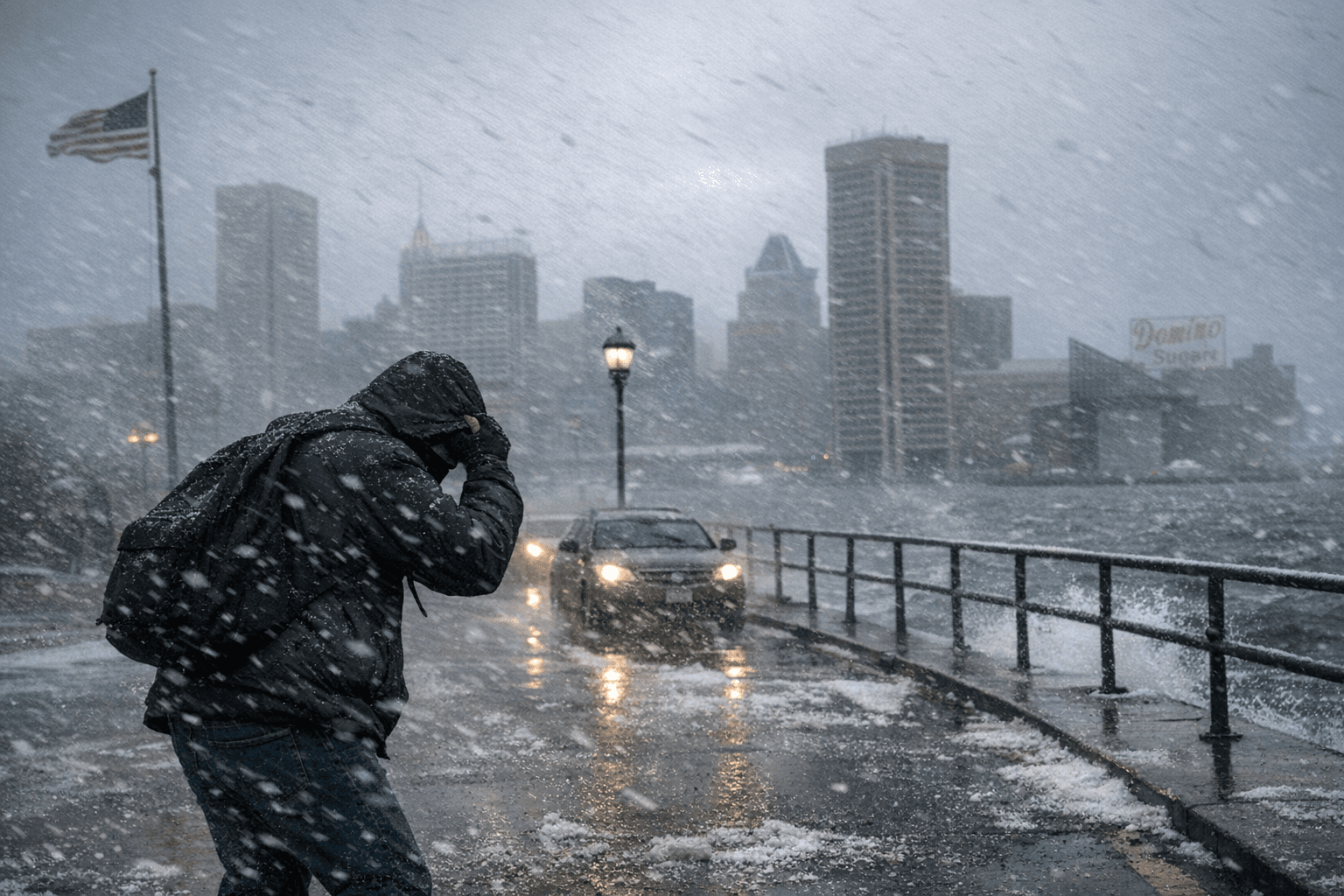
Though the event was limited in scope, the combination of freezing precipitation and strong winds matters for Baltimore residents. Even a coating of sleet or flurries can create slick bridges, overpasses and untreated neighborhood streets during morning and evening commute times. Wind gusts in the 30 to 40 mph range raise the risk of falling branches, unsecured debris and short-term power flickers that disproportionately affect older housing stock and blocks with large trees.
Public health implications can be immediate and unequal. Older adults, people with mobility challenges and neighbors without stable heating are at higher risk for falls, hypothermia and complications from sudden temperature drops. Outdoor workers, delivery drivers and postal carriers face hazardous footing and amplified wind chill. People experiencing homelessness are especially vulnerable when gusty, cold conditions move through quickly, putting pressure on shelters and outreach services.
For community planning and policy, the episode underscores perennial gaps in equitable winter readiness. Baltimore City’s response capacity depends on prepositioned salt and plows, clear sidewalk maintenance and outreach to at-risk residents. Neighborhoods with uneven sidewalk repair and lower rates of vehicle ownership often face longer disruptions when even light wintry precipitation reaches the ground. Local emergency planners and elected officials regularly point to the need for targeted support for seniors, people with disabilities and those in housing insecurity during short-duration cold snaps.
Residents should treat forecasts of sleet or icy flakes seriously even when accumulation is expected to be minor. Check transit schedules, allow extra travel time, secure loose outdoor items and look out for neighbors who may need help clearing steps or getting to warm spaces. Community groups and block associations can play a role by sharing updates and coordinating assistance during the first few hours after a front moves through.
The takeaway? A little wintry mix can still rattle daily life in Charm City — layer up, give yourself more time on the road and check on anyone who might not weather the wind and cold as easily. Our two cents? A small act of neighborly help goes farther than you think when the temperature drops.
Sources:
Know something we missed? Have a correction or additional information?
Submit a Tip